


File:Aerial view of Tyre.webp
No higher resolution available.
Aerial_view_of_Tyre.webp (797 × 578 pixels, file size: 136 KB, MIME type: image/webp)
Summary
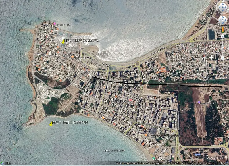
Aerial view of Tyre, showing the ancient northern and southern harbours, indicated by the yellow pins. The black horizontal line indicates the path of the causeway built by Alexander the Great (332 BC). The minimum width of the isthmus is 530 m.
File history
Click on a date/time to view the file as it appeared at that time.
| Date/Time | Dimensions | User | Comment | |
|---|---|---|---|---|
| current | 21:59, 19 September 2026 | 797 × 578 (136 KB) | Terranovas67 (talk | contribs) | Aerial view of Tyre, showing the ancient northern and southern harbours, indicated by the yellow pins. The black horizontal line indicates the path of the causeway built by Alexander the Great (332 BC). The minimum width of the isthmus is 530 m. |
You cannot overwrite this file.
